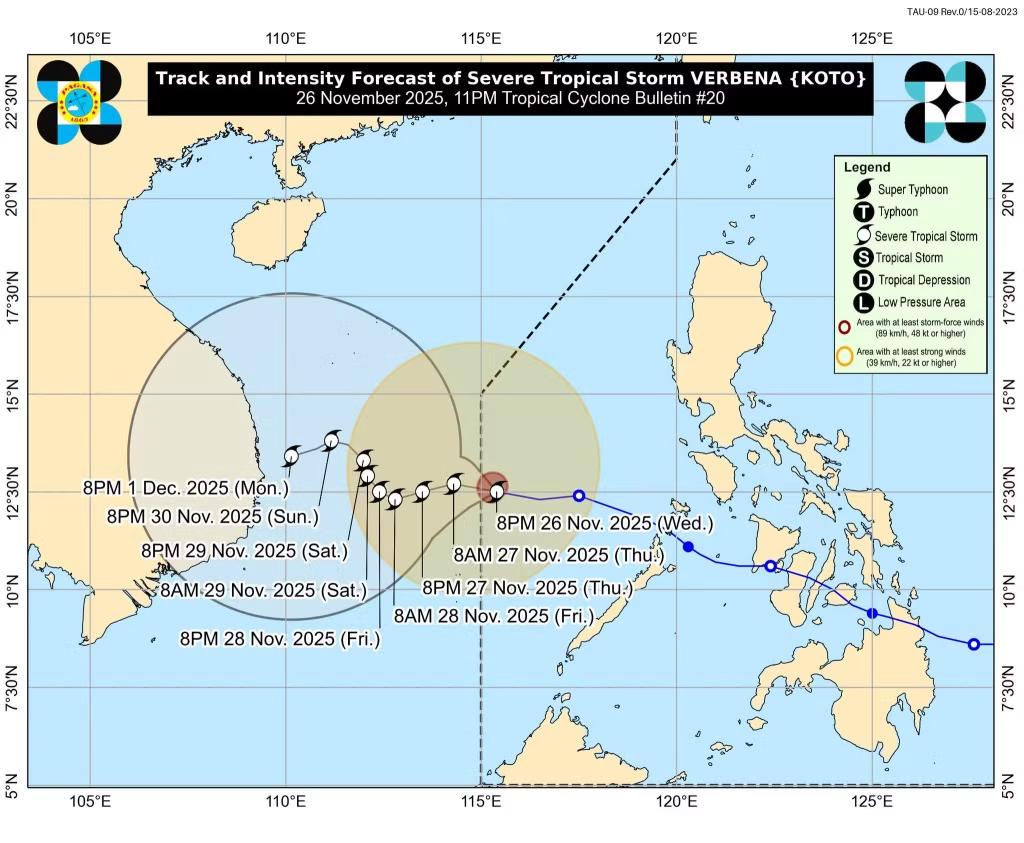
MANILA – Severe Tropical Storm Verbena is poised to bid farewell to the Philippine area of responsibility (PAR) as early as tonight or early Wednesday morning, according to the latest bulletin from the Philippine Atmospheric, Geophysical, and Astronomical Services Administration (PAGASA). Clocking in at 215 kilometers north-northeast of Pag-asa Island in Kalayaan, Palawan, the storm is barreling westward over the West Philippine Sea at a brisk 20 kilometers per hour, packing maximum sustained winds of 95 kph near the center and gusts up to 115 kph.
“It’s forecast to exit the [PAR] tonight or early tomorrow morning,” PAGASA noted in its 11 p.m. update on November 26, underscoring a swift departure that should ease immediate threats to the archipelago’s mainland. But Verbena isn’t going quietly – forecasters predict it will ramp up strength over the next 48 hours, thanks to a supportive atmospheric setup, before the northeast monsoon (amihan) nudges it into a slight weakening phase later in the week.
Once clear of PAR, the storm’s pace is expected to hit the brakes dramatically. It’ll crawl west-southwestward until Friday morning or afternoon, then pivot to a sluggish north-northwestward drift through Sunday afternoon, PAGASA detailed. By then, it’ll swing back west-southwestward, lingering in the region for the foreseeable forecast window. For now, the only active alert is Tropical Cyclone Wind Signal No. 1 over the remote Kalayaan Islands, signaling minimal to minor impacts like possible light damage to structures and brief interruptions to power and water.
As Filipinos brace for the holiday stretch, Verbena’s timely exit offers a breather from what could have been a more disruptive visitor. Still, with intensification on the cards, maritime and aviation folks in the West Philippine Sea are urged to stay sharp – no room for complacency when the weather’s got its own itinerary.