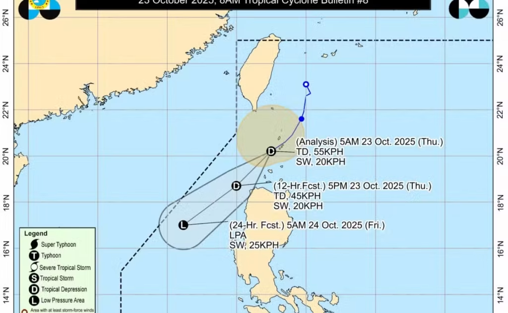
The weather system formerly known as Tropical Storm Salome has weakened into a tropical depression, prompting a shift in travel and safety advisories across northern Luzon.
According to the Philippine Atmospheric, Geophysical and Astronomical Services Administration (PAGASA), the system was last tracked 85 km southwest of Basco, Batanes, moving southwest at roughly 20 kph. It was recorded with sustained winds of 55 kph near its centre and gusts up to 75 kph.
PAGASA has raised Tropical Cyclone Wind Signal No. 1 for:
- Batanes
- The northern and western portions of the Babuyan Islands (Calayan Is., Dalupiri Is., Babuyan Is.)
- The northwestern portion of Ilocos Norte (including Bangui, Pagudpud, Burgos, Pasuquin, Bacarra, Laoag City)
Though Salome has weakened, it is still expected to bring gale-force winds and heavy rain, particularly in northern Luzon. It is forecasted to continue degrading into a remnant low by Friday.
Officials advise residents and travellers to stay alert, monitor local advisories, and prepare for possible disruptions in transport, power, and local flooding.
Why This Matters
- Even weakened systems can cause strong winds, heavy rainfall, flash flooding, and landslides — especially in mountainous or coastal regions.
- The specific areas under watch — Batanes, Babuyan Islands, Ilocos Norte — are more vulnerable due to terrain and maritime exposure.
- With the system moving southwest toward the West Philippine Sea, precaution remains essential even if the cyclone intensity is dropping.
Immediate Safety Tips
- Avoid going out or boarding small craft in areas under Signal No. 1 until the weather subsides.
- Secure loose items around homes and check drainage systems for heavy rain.
- Stay tuned to trusted sources (PAGASA bulletins, local government announcements) for any changes in signals or hazards like landslides.
- Those travelling through northern Luzon should consider alternate plans — especially ferry or coastal trips — and anticipate delays.